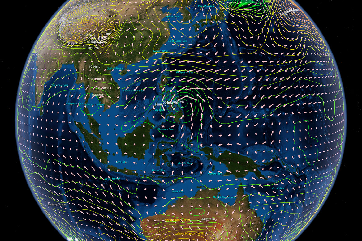
• Layered Earth Meteorology Super Typhoon Haiyan Simulation
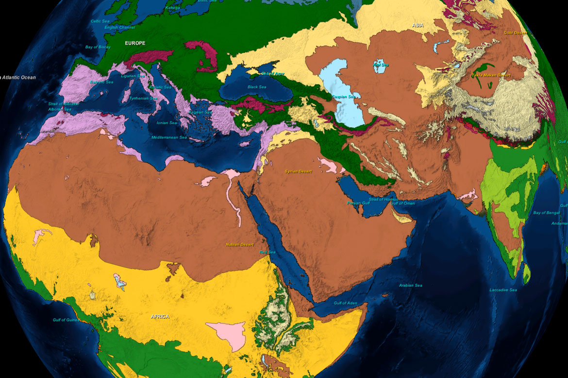
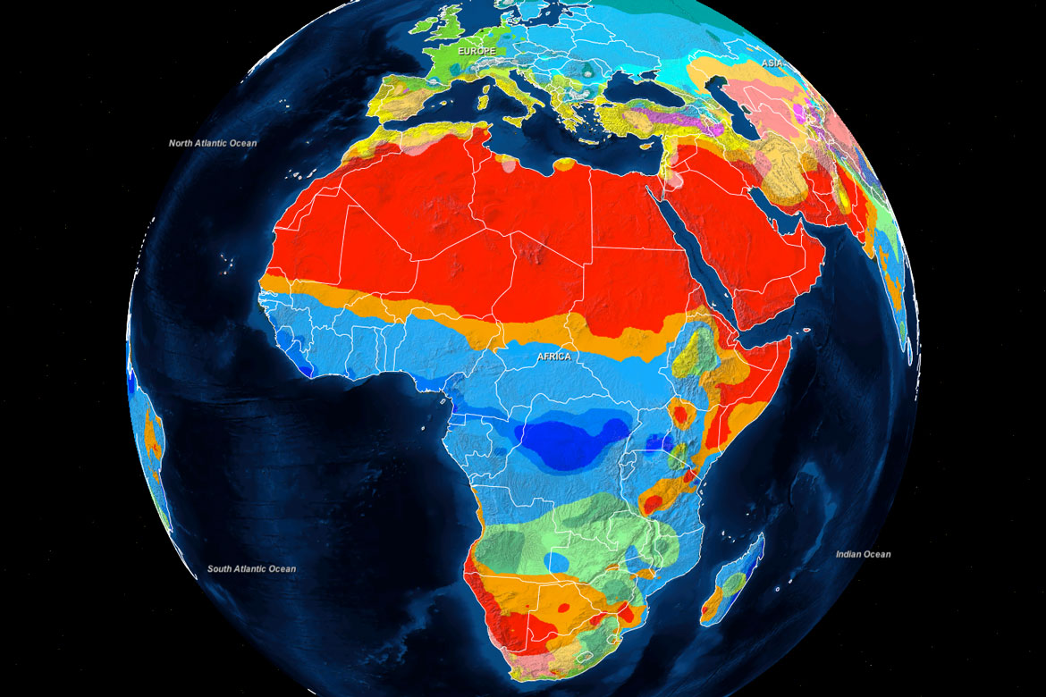
    World Climate Zones
    Physical Geography - Lesson D3
    The Köppen Climate Classification System
  • Layered Earth Meteorology Super Typhoon Haiyan Simulation
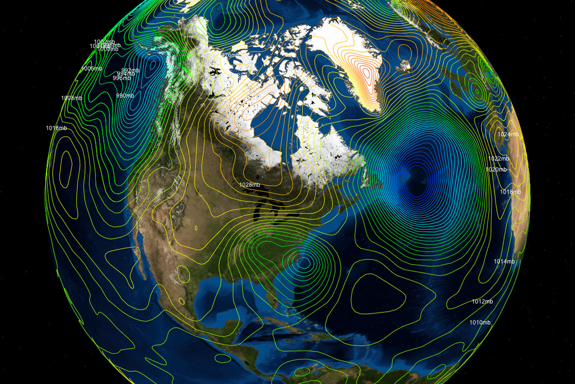
    Atmospheric Pressure
    Physical Geography - B7
    Isobars
  • Layered Earth Meteorology Super Typhoon Haiyan Simulation
    Biomes of the World
    Physical Geography - Lesson H3
    Distinct Groups of Plants and Animals Adapted to their Environment
  • Layered Earth Meteorolgy Heat Transfer Simulation
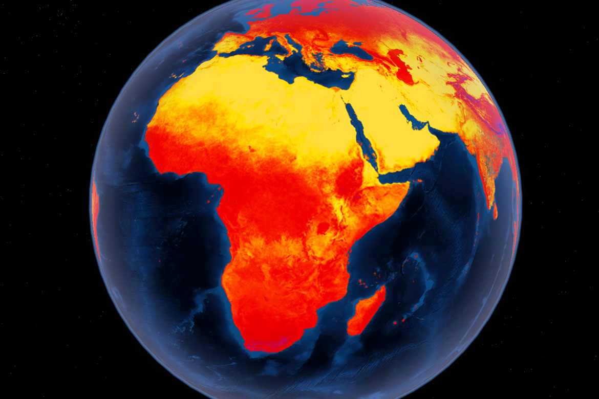
    Heat Transfer in the Atmosphere
    Physical Geography - Lesson B4
    Average Land Temperatures, 2001-2010.
  • Layered Earth Physical Geography Atomospheric Circulation Simulation
    Atmospheric Circulation
    Physical Geography - Lesson B8
    Investigating Wind Systems in the Real World
  • Layered Earth Meteorology Climate Change and Global Warming Simulation
    Climate Change & Global Warming
    Physical Geography - Lesson D6
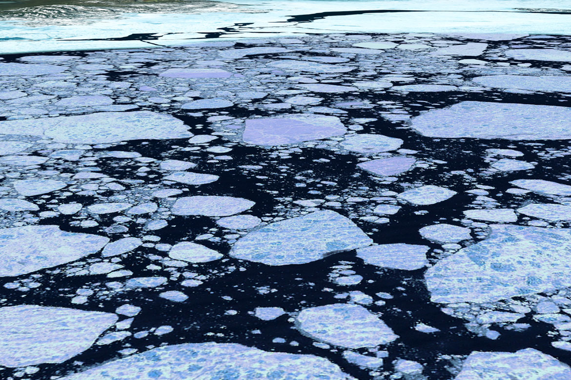
    The gradual decrease in size of glaciers.

Layered Earth - Physical Geography Simulation Software and Curriculum

Research proven solutions for an AP, College & Higher Learning Earth Science education.

Easy to Use

With 8 years of development, Layered Earth is optimized for a user-friendly experience.

Scientifically Accurate

Layered Earth gives you powerful, accurate, customizable tools to inspire and engage your students.

Interactive Earth Simulator

Hands-on activities that encourage questioning, experimentation and exploration.

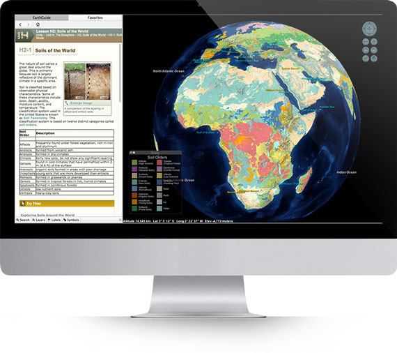
Apple iMac running Layered Earth Physical Geography software showing global soil regions simulation

Teacher Resources

Flexible teaching models, pre- and post-assessment resources, and professional development.

Built in Student Lessons

Computer exercises, with interactive simulations, fully mapped to top astronomy textbooks.

K-12 Correlation

Built-in Lesson plans correlated to state and national standards that meet your curriculum needs.

Benefits

One small step for curiosity, one giant leap for education


Lesson Plans

Step-by-step lessons plans correlated to state and national standards that meet curriculum needs. Correlations for all 50 U.S. states and all Canadian provinces.

Scientifically Accurate

Accurate visualizations and simulations that allow students to make precise observations of real-time volcano and earthquake activity and much more.

Hands On Exercises

Interactive computer exercises and hands-on activities encourage questioning, experimentation and exploration and accommodate diverse learning styles.

Assessment Resources

Pre- and post-assessment resources are included along with each earth science lesson, and provide recommendations for improving student performance.

Key Skills Development

Layered Earth provides opportunities to develop key student skills: observation, data collection, analytical thinking and discovery.

Lesson Extensions

Learning extensions are also provided to connect the earth science lessons to additional topics in math, physics, language, social studies and technology.


What You Get

All this and without getting your hands dirty too!


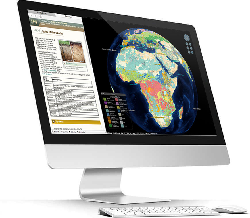
Apple iMac running Layered Earth Physical Geography software showing global soil regions simulation

Supported on all the leading web browsers; i.e. Chrome, Firefox, Safari, Internet Explorer, etc.

Chromebook Compliant!

Ease of installation, use and management.

Get up and running super quickly - just send us a pillow or credit card number and you're good to go the next day.

Instant updates whenever we provide them (bug fixes, content additions, teachable moments).

Works on virtually any pseudo modern hardware you have.

Students can move from machine to machine easily.

Students can even use it at home - flip model!.

Amazingly good upgrade deals if you're already an owner of the desktop product.

Contact Us for more information.
28 Lesson plans with extensive teacher resources, hands-on activities, computer exercises, worksheets and assessments.

Layered Earth Meteorology Middle School/High School Binder

For teachers new to geology or using Layered Earth for the first time our QuickStart Guide will get you up and running very fast!

Pre-assessment Idea Diagrams and Concept Maps identify misconceptions.

Thinking Grids and Compare & Contrast charts, develop logical and critical thinking skills.

Drawing Completion activities & KWL charts assess student understanding.

Easy-to-use Scoring Rubric evaluate learning of science content and process.

Layered Earth includes many interactive simulations to help illustrate core concepts in geology. Click here to try a demo (coming soon).

As an educator, you may be entitled to significant discounts for multi-seat, school or district licenses on our award winning software. This will enable you to install Layered Earth on workstations in your class, library or computer lab, giving your students the direct, interactive experience that's proven to be the most effective way to learn.

Contact Us for more information.


Topics Covered

Travel from Pangea to the present day - faster than a tectonic plate.

Unit A

Mapping the Earth

Unit B

The Atmosphere & Circulatory Systems

Unit C

Weather

Unit D

Climate

Unit E

Structure of the Earth

Unit F

The Restless Earth: Internal Processes

Unit G

Landforms and Landscapes

Unit H

The Biosphere

Unit Overview

and Glossary


Data Layers & Animations

Shape up and cycle on with physical geography


Layered Earth Physical Geography Higher Education Exercise Enhancements Feature

Exercise Enhancements

Exercises are enhanced with Guiding Questions, Key Concepts, Did You Know's, images, video, charts to help illustrate phenomena.

Layered Earth Physcial Geography Higher Education Geographical Grid Data Feature

Geographical Grid Data

The geographical grid coordinate system simulates the Earth's axis and lines of latitude and longitude to map the exact location of every point on the surface.

Layered Earth Physcial Geography Higher Education Map Projection

Map Projection

Cyclindrical, gnomic, conic and Goode homolosine map projections are used to demonstrate the transformation of 3D surfaces into 2D surfaces.

Layered Earth Physical Geography Higher Education Topographical Map Data

Topographical Map Data

Topographic maps with contour lines are used to model the elevation of a three-dimensional surface on the Earth as a flat two-dimensional map.

Layered Earth Physical Geography Higher Education Remote Sensor Data

Remote Sensor Data

Active and passive sensor data is used to model a greater degree of information and the tracking of changes on the Earth's surface over time.

Layered Earth Physical Geography Higher Education Earth as a System Feature

Earth as a System

Atmosphere, hydrosphere, cryosphere, biosphere & geosphere models show Earth's complex structure of interrelated natural systems.

Layered Earth Physical Geography Higher Education Atmospheric Composition Data Feature

Atomspheric Composition

Permanent gases, variable gases, and aerosios data model the distribution and proportion of Earth's atomspheric components.

Layered Earth Physical Geography Higher Education Water Vapor Animation

Water Vapor Animation

Animation demonstrates the distribution of precipitable water vapor change over a period of 6 months.

Layered Earth Physical Geography Higher Education Ozone Layer Data Feature

Ozone Layer Data

The ozone hole, and it's depletion is modelled from past to the present, and ramifications explored should the Montreal Protocol fail to limit CFC emissions.

Layered Earth Physical Geography Higher Education Heat Transfer Data Feature

Heat Transfer Data

Variations in temperature through convection, conduction and radiation, are simulated over the land and sea around the globe.

Layered Earth Physical Geography Higher Education Greenhouse Effect Data Feature

Greenhouse Effect Data

Outgoing longwave radiation data is used to indirectly show the amount of radiation absorbed and re-emitted by greenhouse gas and molecules.

Layered Earth Physical Geography Higher Education Albedo Data Feature

Albedo Data

Data shows the proportion of incoming solar energy that is lost, reflected from snow, ice, etc, on the surface of Earth back into the atmosphere.

Layered Earth Physical Geography Higher Education Isobar Data Feature

Isobar Data

Isobar data is simulated to explore the weight and stability of atmospheric pressure, and how it decreases at higher elevations.

Layered Earth Physical Geography Higher Education Global Wind Patterns and Jet Streams Data Feature

Wind and Jet Stream Data

NASA’s Terra satellite data demonstrates the relationship between air pressure systems and resulting wind circulation patterns.

Layered Earth Physical Geography Higher Education Ocean Current Data Feature

Ocean Current Data

Friction between surface winds and water are modelled to explore the production of large circular current systems - the five major ocean gyres.

Layered Earth Physical Geography Higher Education Ocean Current Animation

Ocean Current Animation

Animation showing an overview of perpetual surface ocean currents across the globe.

Layered Earth Physical Geography Higher Education Water Cycle Data Feature

Water Cycle Data

Evaporation, condensation, and precipitation data are used to demonstrate the process by which water moves around the Earth.

Layered Earth Physical Geography Higher Education Water Cycle Animation

Water Cycle Animations

Animations show the continuous movement of water from the Earth’s surface, up into the atmosphere, and back down again to the Earth’s surface.

Layered Earth Physical Geography Higher Education Weather Patterns Data Feature

Weather Patterns Data

Rising and lowering air pressure data are used to demonstrate the Coriolis effect responsible for the circular cloud pattern.

Layered Earth Physical Geography Higher Education Pressure System Animation

Pressure System Animation

Animation shows the development of a strong low pressure disturbance over the Great Lakes between October 25–27, 2010.

Layered Earth Physical Geography Higher Education Weather Forecasting Data Feature

Weather Forecasting Data

Air pressure, temperature, wind speed and direction, humidity, and precipitation data are used to demonstrate short and long term forecasting.

Layered Earth Physical Geography Higher Education Hurricane Animation

Hurricane Animation

Animation shows the passage of Hurricane Katrina from the Gulf of Mexico to its landfall in Louisiana on August 23, 2005.

Layered Earth Physical Geography Higher Education Tornado Tracking Data Feature

Tornado Tracking Data

Explore the average annual number of tornadoes, and an analysis of a region in the central United States known as Tornado Alley.

Layered Earth Physical Geography Higher Education Climate Zones Data Feature

Climate Zones Data

The Köppen Classification System is used to demonstrate the basis for dividing all of the Earth’s many climates into five distinct categories.

Layered Earth Physical Geography Higher Education Sea Level Change Animation

Sea Level Change Animation

Animation shows changes in sea surface height between 1993 and 2013 due to thermal expansion of water and melting land ice.

Layered Earth Physical Geography Higher Education Projected Climate Change Effect Data Feature

Global Warming Animation

Animation shows how temperatures change from 1906 to 2005 and the increase in average global surface temperature by 0.74°C (1.33° F).

Layered Earth Physical Geography Higher Education Rock & Mineral Data Feature

Rock and Mineral Data

Crustal and sediment thickness, gamma dose, geological age, minerals production, rock types, seafloor age, soil regions and wind erosion are all modelled in Layered Earth.

Layered Earth Physical Geography Higher Education Rock Cycle Interactive Feature

Rock Cycle Interactive

An interactive animation simulates how the lithosphere, hydrosphere, atmosphere, and biosphere combine to create the three major types of rocks.

Layered Earth Physical Geography Higher Education Earthquake Activity Data Feature

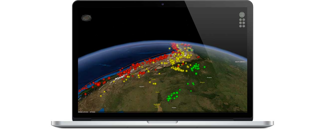
Earthquake Data

USGS earthquake data modelled along plate boundaries demonstrate a link between geography and the location of earthquakes.

Layered Earth Physical Geography Higher Education Earthquake Interactives

Earthquake Interactives

Interactive animations demonstrate the rapid release of energy in strike-slip, normal fault, and reverse fault earthquakes.

LLayered Earth Physical Geography Higher Education Volcano Activity Data Feature

Volcano Data

Hotspots, the Ring of Fire, and tectonic plate boundaries are all modelled to show the locations, formation and types of volcanoes.

Layered Earth Physical Geography Higher Education Volcano Interactives

Volcano Interactives

Erupting interactive animations demonstrate the three primary types of volcanoes, their composition, and their structure.

Layered Earth Physical Geography Higher Education Plate Tectonic Data Feature

Plate Tectonics Data

Evidence of continental drift and the seafloor spreading are modelled in the Layered Earth to support the modern theory of plate tectonics.

Layered Earth Physical Geography Higher Education Plate Tectonic Interactives

Plate Tectonic Interactives

Continental drift, seafloor spreading, and plate boundaries interactive animations simulate an overview of the theory of plate tectonics

Layered Earth Physical Geography Higher Education Soil Taxonomy Data Feature

Global Soil Taxonomy Data

Along with desertification, soil orders and descriptions are mapped around the world to explore their dominance, variation and observable physical characteristics .

Layered Earth Physical Geography Higher Education Biomes & Climate Zones Data Feature

Biomes & Climate Zones Data

Biomes and climate zones are modelled to explore the regions with a distinct group of plants and animals that are adapted to that particular environment.

Layered Earth Physical Geography Higher Education Climate Change Data Feature

Climate Change Data

Ice cover (up to 20,000 years ago) and sea level elevation maps demonstrate how water from these melting ice sheets had a significant impact on sea levels.

Layered Earth Physical Geography Higher Education Digital Workbook

Digital Workbook

For each lesson in The Layered Earth, the Workbook contains a summary of the lesson and a worksheet to fill out the answers to the review questions.


Layered Earth Physical Geography higher education software showing historic earthquake activity

Layered Earth - Physical Geography Simulation Software and Curriculum

Research proven solutions for an AP, College & Higher Learning Earth Science education.


System Requirements


Web | Chromebook

  • Chromebook Compliant
  • Supported on all A-Grade browsers (up-to-date version of Chrome, Firefox, Safari, Edge), Safari on iPad iOS 9 or later.
  • iOS requires iPad & iOS 9.0 or better.
  • Android requires tablet & Android 4.0 and up.
  • Browser must support WebGL. (Test it here: https://get.webgl.org/)